The lower slopes
Despite misleading reports by certain news outlets giving the impression that one year after the earthquake there's not much left to go to Kathmandu for, I thoroughly enjoyed my experience there - it was a sort of gateway to Nepal. There's no better place to start.
Although there were many intriguing things to see in the city, I'm not going to lie - I was glad to swap it's dust, sweat and honking horns for the Himalayan foothills. But the horns aren't something you lose immediately - the bus drivers lean on them to warn others as they hurtle around hairpin bends. I sat back and watched as the city gave way to arid hills and dry paddyfields, which are crying out for rain by this time of year. These turned into a river valley where white water rafting is popular and finally we headed into gorges and valleys that would already dwarf anything we have in the UK.
After a rainy overnight stay in Besisahar, I set out with my vivacious Nepalese guide Ritu, whom I met up with in Kathmandu, and Lal, my porter (there's no way I could carry my own bag for 17 days, let alone at high altitude. I'm full of admiration for those who do). As I laced up my boots and prayed to the gods of blisters to stay away, I could barely contain myself as I hefted my rucksack on. As we set out, I had to keep reminding myself that this was the first day of 17 days of hiking and that I needed to find a steady pace. But I ended up practically skipped from rock to rock, gleefully drinking in the lush green valleys, which were far greener than the countryside we'd driven through. We passed by currently unused rice paddyfields (being prepared for rainy season), corn fields and banana trees... and a hydroelectric plant under construction. The Chinese are building it and employing local workers and in turn are building drainage systems for the local villages. This did mean that for some of the way we had to walk along the much-disputed road, which is dusty and you frequently need to keep moving out of the way for jeeps. There's a painful contradiction here - the plant and road itself are creating jobs and much-needed electrical power but at the same time affecting the natural beauty of the place and so driving away the trekkers. At our lunch stop we met some of the workers and through Ritu I found out how pleased they were with their Chinese bosses. But later we would come across teahouse and restaurant owners who were concerned that their businesses were on the decline, which is particularly difficult in this year after the earthquake.

The beginning of the Circuit is still at a relatively low elevation, which means that you're hiking in heat that's up to the mid-thirties celsius at this time of year. The first day itself is not difficult and at this point I was still blissfully enjoying sunshine after many rainy dark months in England. We only encountered one other walker that day, an American lady with open, good-looking features and a stoic approach - more on her later. Although I created my usual protective turban and drank shedloads of water the sweat was indeed pouring off me by two in the afternoon as I panted up one final hill to our first overnight stop on the trail at a guesthouse, most spectacularly situated above the village of Bahulbule. Lal had already made an impression, not only carrying my backpack but his own, smaller one too. He's a small, quiet, older man but there's not a shred of excess fat on him, just muscle, and he carried my load in the heat without a flicker of an eyelid.
As the savage heat of the day faded and after I'd done the chore of washing clothes by hand (yes, already!) I wandered over to the terrace of the neighbouring guesthouse to study the valley below. There I met a very elderly lady whom I could only guess was either the owner or relative of the owner. She invited me to sit with her and although she had only a few words of English and I had a shameful two words of Nepalese I think she understood that I was doing the Circuit and that she herself had walked some of it in the past as part of a pilgrimage to the temple at Muktinath, including the high Thorung La pass. As the fingers of sunlight slipped away from the valley, I looked down into it and couldn't help but feel that, in her old age, she had something wonderful at her feet that she could look at every day.

The second day, I woke with difficulty - a combination of heatstroke and the start of my period was not an enjoyable combination. But isn't this what it's all about? Trying to manage your body and make it fit for purpose. There are many restaurants and guesthouses along the way that cater to tourists and there's a choice of food but the standard fare is dal bhat - lentil curry and rice with other side dishes, thali style, which is a sensible choice if you're trekking. Unfortunately my usually ample and adventurous appetite was waning and I almost fell sleep at the lunch table. However it was the rain that afternoon that revived me, as well as the antics of a dog (puppy really) that adopted us - he would dash ahead, sniff around or play a little, lie down, wait and then just as we reached him, repeat the game, sometimes getting under our feet and annoying Lal. I named him Chamje, as he almost walked all the way there with us. We slowly gained ground and followed the course of a narrow valley, almost a gorge that towered above us and all the while we followed the great, grey-green, rushing Marsyangdi River. We stayed in a guesthouse not far from the precipice and all through the night I could hear the river rushing and gushing on its way down to meet the Ganges. If there's one thing India needs from Nepal, it's fresh water.

Finally I hit my stride on the third day - we left the road behind and took a path that took us up way above the valley, past longur monkeys, their black faces watching us from the depths of their home in the trees, opposite an enormous waterfall (and across some large rocks that looked like they were part of a waterfall too). We passed under and over boulders that were the size of houses, huge slabs that looked as if they'd been abandoned millions of years ago by giants in the middle of a rock-throwing contest. Passing through a Buddhist threshold, we entered a new valley, on which sat the village of Tal. The contrast was tremendous - from narrow valley to vast open plain. The guidebooks don't lie when they describe Tal as being like a Western frontier town, with it's colourfully-painted wooden guesthouses. After a relatively quiet few days of trekking, that afternoon we finally started to meet other trekkers. There was Korean Man (a cheerful and cheeky fellow, he was delighted with Ritu's nickname for him - he'd thought she was Korean herself, which is how we got chatting to him). There was a hot and unhappy Manchunian who implored me to tell him when the road was going to end (admittedly, it is tough going as it's so dusty and having to get out of the way for cars is no pleasure). There was the young Chinese boy of no more than twenty, with a wisp of a moustache and who didn't speak any English but gravitated towards us and we walked with him in companionable silence for at least a half hour, he occasionally taking videos of the landscape (and us!). It's funny to think, when you leave someone like this behind, that one day he'll be there, in China, showing his family all his wonderful videos and photos and there we will be, nameless friendly faces whose paths he crossed for a few moments. And finally the chap from the Cezch Republic at our guesthouse that evening - we'd seen the big, long-haired man and his partner several times since Besisahar. It transpired that he was a photographer who had been to the same area five years ago. He'd been charmed by the local people and had taken photographs of a some of them which ended up in a successful exhibition in Prague in aid of the Nepal earthquake fund. The exhibition had done so well that he had come back to present his subjects with large-sized prints of themselves and was on a mission to find each of them - in all it looked like there were about fifteen or twenty and he had about six left to find.

Taking an afternoon snooze - one of the many canine wanderers of Nepal.
The hills
The following day we reached what I'd been waiting many years to see. As we turned another valley corner above the Marsyangdi, the Annapurna peaks revealed themselves in all their snowbound, majestic glory. Pisang Peak was the first to emerge, alongside an astonishing curving rock that looks like part of a velodrome. The local people believe that the spirits of the dead must ascend this wall in order to get to heaven.

As I stood on a footbridge that swayed with my weight and looked all around me at the mountains rushing up from the ground to meet the sky, I took a long deep breath. Then I looked down at the grey-green water gushing beneath me into the valley over huge, smooth grey boulders and almost cried with sheer happiness to be alive. I say that with no trace of sarcasm. I was just so touched that such a beautiful scene could exist. I felt surrounded by high peaks. But Ritu told me that many of these were hills - in the region of 3,000 - 4,000m high and I suppose in the Himalayas that is the case, even if these hills are actually higher than any of our mountains in the UK. This was also the day that I discovered that people cycle the Annapurna Circuit. Over the pass - yes, you read that right - *cycle* over the pass. I'm still digesting that news now... We met a couple of intrepid Australians and what can only be described as a Swiss team who looked more than ready for the assault (or do I meant ascent? I'm not sure which). By this time I had started to feel the cold creep in for the first time.

Mid-morning vegetable samosa break at a snack stand above the river. Normally hard to please when it comes to samosas, I've got to say these were among some of the best I've ever tasted.
Up where the air is clear
We spent that night at lower Pisang, 3,200m. Unfortunately I am cursed with particularly low tolerance when it comes to the cold but for this trip (having learned the hard way on Kili) I made the equipped myself properly. Starting out with socks, thermal leggings and top, hat, thin gloves, fleece-lined hoodie and down vest in my sleeping bag, throughout the night I gradually managed to divest myself of all of these save my thermals even though it was below freezing and snowing outside. The guesthouses don't have heating but do provide heavy blankets - though I found that my -12C sleeping bag was up to the job.
In the morning we were rewarded with clearer views of Pisang peak and the hills and for the frist time I set out in a hat and gloves. As we left the village we passed by more prayer wheels, which by this part of the trek were becoming commonplace.

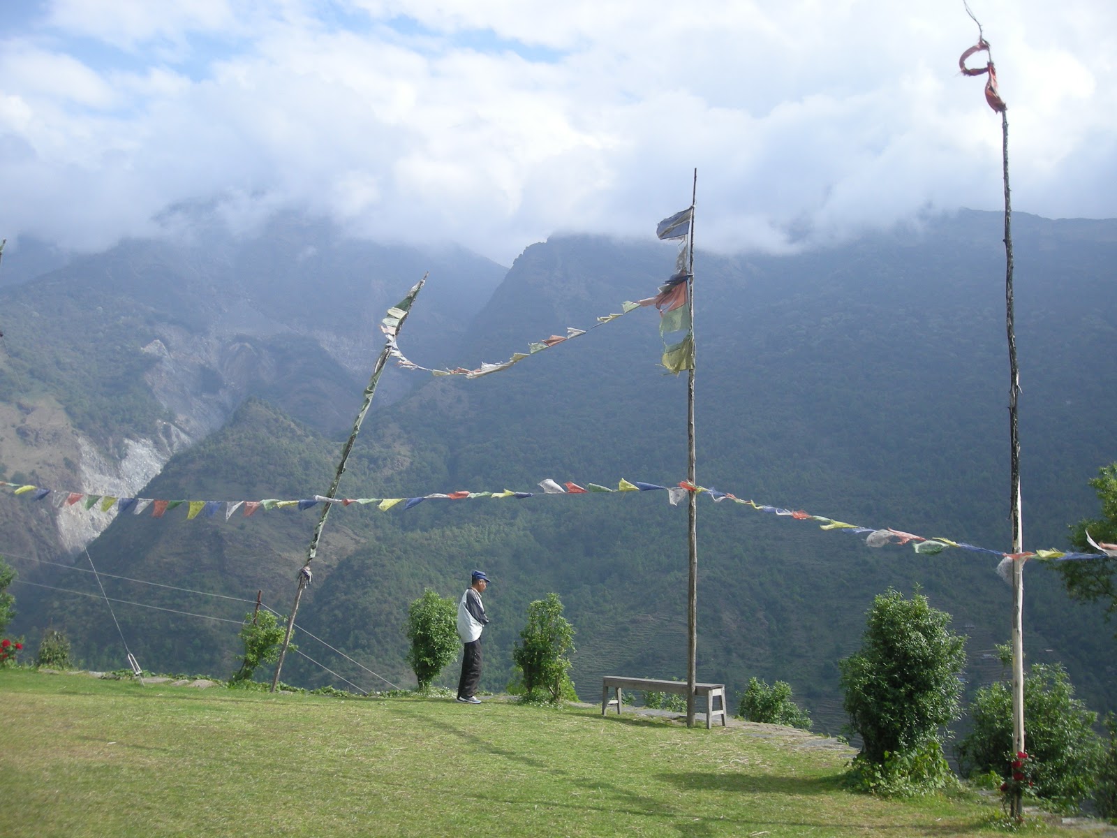
Buddhism is widely practised up in the mountains. Communities will come together to fund the building of stupas, mani walls and prayer wheels, inscribed with Tibetan script. The 'Om mani padme hom' mantra is widely chanted (here's further explanation of its meaning and interesting fable). You can often hear recordings of it being played in guesthouses or shops. Spinning the prayer wheels that contain copies of the mantra inside and repeating the mantra itself are thought to have the same benefit - of invoking the powerful benevolent attention and blessings of the embodiment of compassion. As they go about their daily lives, people spin the wheels as they pass by the left side of the wheels or mani wall.
Our walk took us upward first, out of an evergreen forest and then we descended onto a wide plain surrounded by peaks. The vast landscape reminded me of something out of an old Western movie. The landscape grew more and more dry until we were trekking across what was essentially desert. I'm going to have to top talking now and just show you some photos - anything I try to say is going to fall short of representing just how beautiful and eternal it feels to be in this primordial place. Unfortunately I'm no pro photographer, so some of these pictures were taken on my little Coolpix, some on my phone but nothing I tried could actually fit everything I needed to get into one shot.


Horses are the livelihood of the people of Manang.

This is Manang, the last major village before Thorung La Pass and where many trekkers stop to acclimatise for a day or two, as did we. It's an arid place at first sight but with stunning surroundings - there's very little vegetation and we arrived the intensity of the sun was notably greater than it had been even if the temperature wasn't all that high. There was a crisp breeze that slipped into the cracks of my clothing and chilled me despite the warm sun.
Literally a few hours later, this was the scene. Below you can see a group of Nepalese tourists - they had spent the last twenty minutes shrieking and running about taking photos of each other - they were thrilled to see snow for the first time.

The following day we took a short hike to Ganggapurna lake, which sits below Ganggapurna mountain (7,455m).

Ganggapurna Tal (or lake).

View of Ganggapurna and its glacier.

Annapurna III, 7,555m.

A walk that should have been a cinch for me was suddenly really very difficulty. Not only was I struggling for breath but I seemed to have lost all energy and my stomach gurgled with every step. I resorted to staring at each bend in the switchback and willing myself just to get there and then thinking about the rest later. The above is the tree under which I collapsed and spent at least an hour staring up at the peaks around me.
Trouble in Manang

Up where the air is clear - by the river at Manang, 3,500m.
It was actually just before Manang that the trouble started. Up to this point, I had a clear head, no aches or pains, no blisters and I was absolutely delighted with my condition even at high altitude. I was going to make it over the pass, no problem. I was visualising it. I was all set. Until I got the dreaded diarrhorea. This is no picnic at 3,500m. Getting out of bed several times in the night to go to the toilet at temperatures below freezing is no fun at all. The next day I made it to Yak Kharka at 4,035m but by this time I was only merely aware of the barren, stark beauty of the high plains around me and was not appreciating any of it anymore. I later discovered that my ailment was just your usual bacterial stomach bug but when there's less oxygen in the air your body has a hard time fighting off infections and it was at this point that I had to make a tough but necessary decision...